Photo by John B. Wellerr
Spatial management
Activities in the Convention Area are regulated through an ecosystem-based approach and a precautionary approach. The Commission adopts conservation measures to regulate activities in accordance with CAMLR Convention Article IX, including on catch limits, gear and other operational issues, and open and closed seasons and areas.
CCAMLR has created a number of management areas, each with specific management requirements. Some areas are closed to certain types of fishing activity. Some are open to fishing but are subject to the requirements of conservation measures, including, but not limited to, when fishing can take place, seasonal catch limits, the data that need to be collected, restrictions on fish by-catch, and requirements for by-catch mitigation measures.
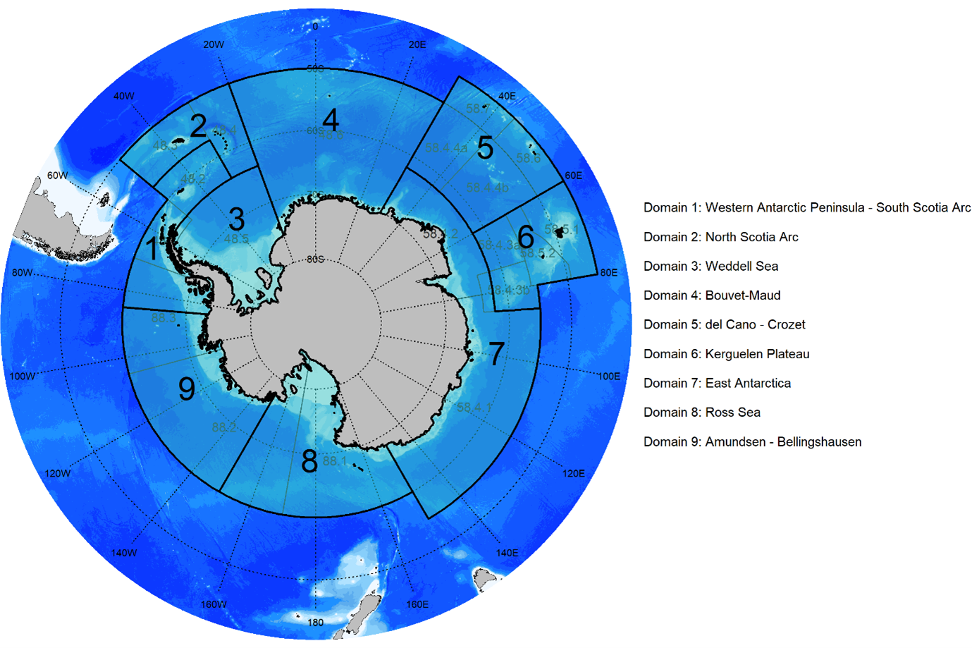
CCAMLR is also developing marine protected areas (MPAs) that are representative of the marine ecosystems in the Convention Area. In the 2000s the Scientific Committee analysed a large amount of biological and oceanographic data to describe the different biological regions that occur within the Convention Area. From this work CCAMLR was able to identify 14 bioregions which were later grouped into 9 large-scale MPA planning domains.
CCAMLR has approved a general framework for establishing MPAs. MPAs may include restricted, prohibited or managed activities and each MPA established under the framework, unless otherwise agreed, shall have priority elements for management plans and research and monitoring plans.
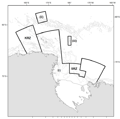
The first high-seas MPA that was agreed by CCAMLR was the South Orkney Islands southern shelf MPA in 2009. The largest high-seas MPA in the world, the Ross Sea region MPA, was agreed in 2016 and came into force in 2017. It includes areas of total protection and some areas where limited fishing is allowed, the Krill Research Zone and Special Research Zone in the figure below (KRZ, SRZ). The objectives of the MPA are to conserve natural ecological structure, provide reference areas for monitoring natural variability and long-term change, promote research, conserve biodiversity, protect large-scale ecosystem processes, and protect core distributions of prey and predator species, areas of ecological importance and rare or vulnerable habitats.
Three more MPAs are currently being considered by CCAMLR in MPA planning domains 1 (Antarctic Peninsula), 3 (Weddell Sea) and 7 (East Antarctica).